Los Angeles Greenway
Reusing the Future Obsolete Freeway Infrastructure
Many world cities have, over the centuries, adapted their infrastructure for new uses. It is a process of urban evolution. A city like Los Angeles is so young that it is only now needing to consider the reuse of infrastructure. Los Angeles, and much of America, tends to destroy previous buildings and replace with new ones, so the act of reusing infrastructure is in many ways a radical departure of the city’s built development.
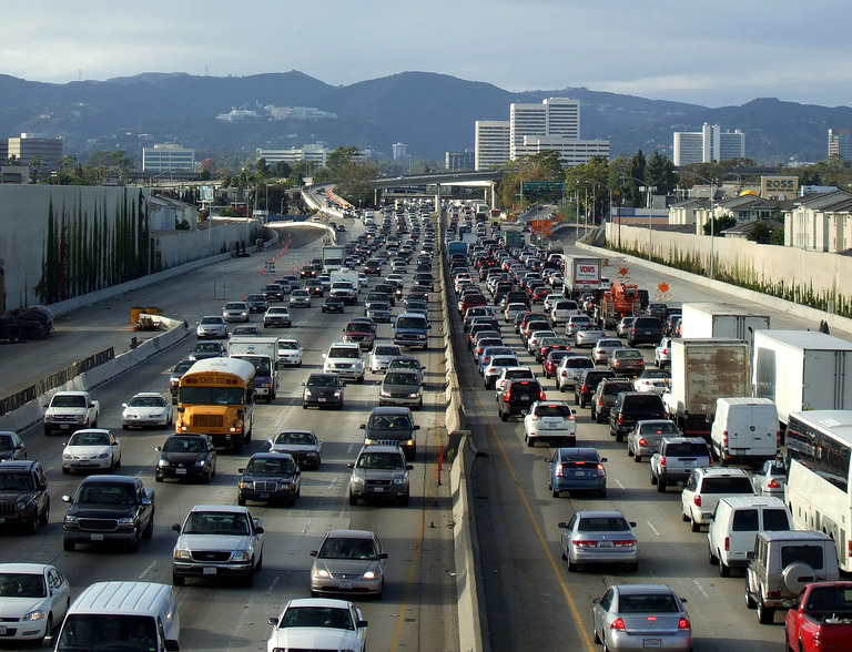
Los Angeles freeways promised speed and connectivity
However, it has only delivered congestion and separation. They are at their tipping point- dysfunctional and on the verge of obsolescence. Like many great cities that have reclaimed the ruins of their infrastructure it is time for Los Angeles to reclaim it’s inevitable and future ruins.
We must turn these concrete rivers of frustration and pollution into something good for everyone in the city.
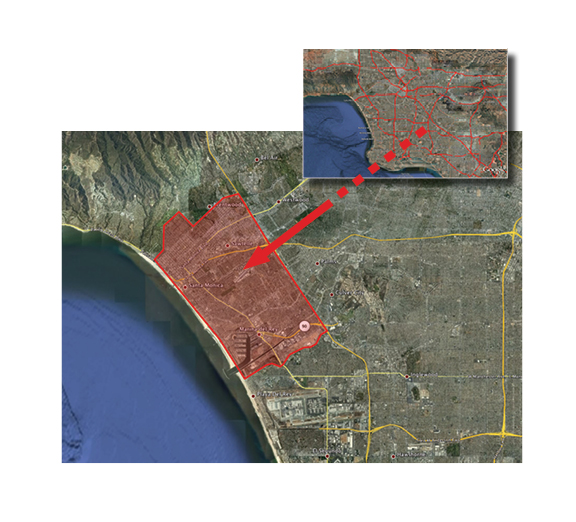
Freeways occupy a huge area of the city
The combined area of all the freeway right-of-ways is greater than the the area of the City of Santa Monica. This network of concrete has the capacity to hold a new kind of urban development of a transformative scale.
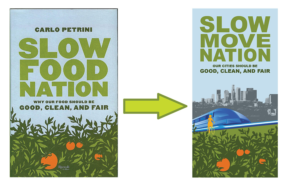
We propose to end this senseless preoccupation with speed, which has delivered anything but. We propose a Slow Move Nation, like the Slow Food Nation. Freeways can be the source of transit and connectivity, as well as parks and valuable green space for an inexorably gray city. Pedestrians, bikes, and light rail will now move along the old freeway routes instead of cars.
The industrialization of the food industry is parallel to the modernization of the transportation industry. Can we learn from the Slow Food Movement?
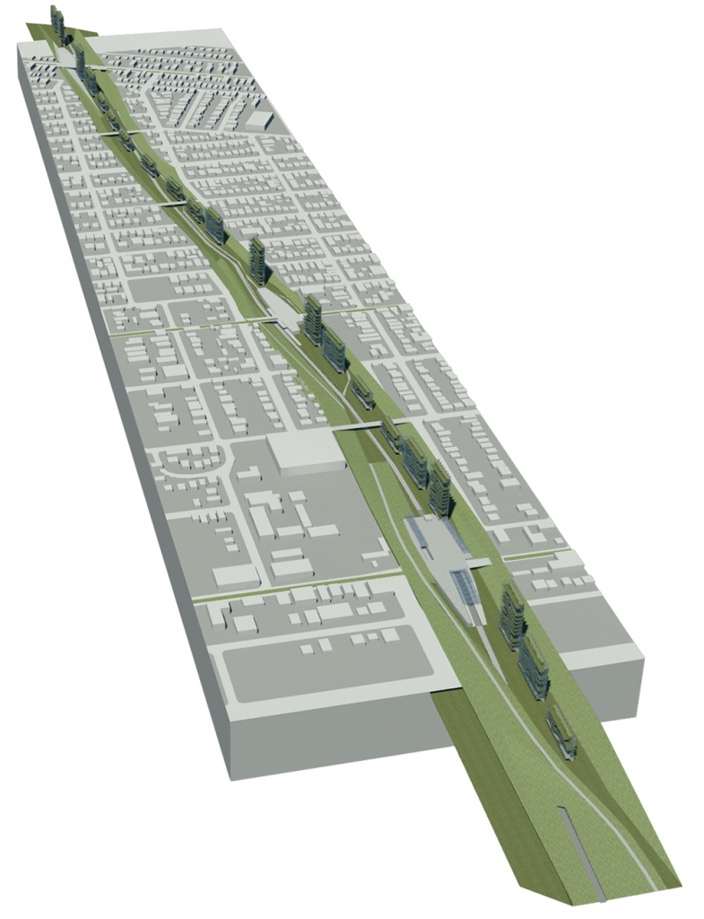
A new green ribbon running through the city
Furthering the movement toward local community (and reducing the egregious transportation miles required by the global agri-industry), we are reintroducing agriculture to Los Angeles through the construction of vertical farms along the freeway. Community gardens would also be created, and new public squares would be both transit hubs as well as farmers markets.
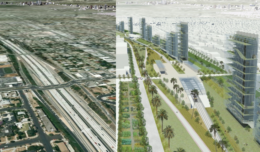
From freeway to greenway
We propose to take this source of unhealthy and unsustainable living (the freeway) and to transform it into a city-wide building site for a Greenway system that can address issues of transit, public space, parks and agriculture. Our project eliminates cars on the current freeway system and creates a Greenway with light rail, bicycle paths, walking promenades, vertical gardens and community gardens.

Partial Site Plan
“This is a sophisticated proposal that radically rethinks Los Angeles’ freeway system, transforming it from the greatest producer of toxins to into the largest green-belt network in the country. At the same time, it retains its role in connection with transit, using existing rights-of-way as dedicated public transportation ways throughout the city. Finally, the jury liked the fact that the architect looked at the freeway cap as valuable real estate, providing an economic engine to propel the development and construction of the other more public-oriented amenities and services.”
Jury comments for Second Prize, Civic Design, Westside Urban Forum, Los Angeles
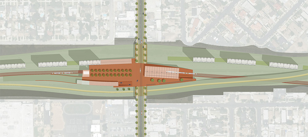
The new Greenway plazas: transit hubs / farmers markets
All major cross-streets will have a new streetcar system that will connect to the light rail station of the new Greenway.
A vision for Los Angeles: from concrete to green
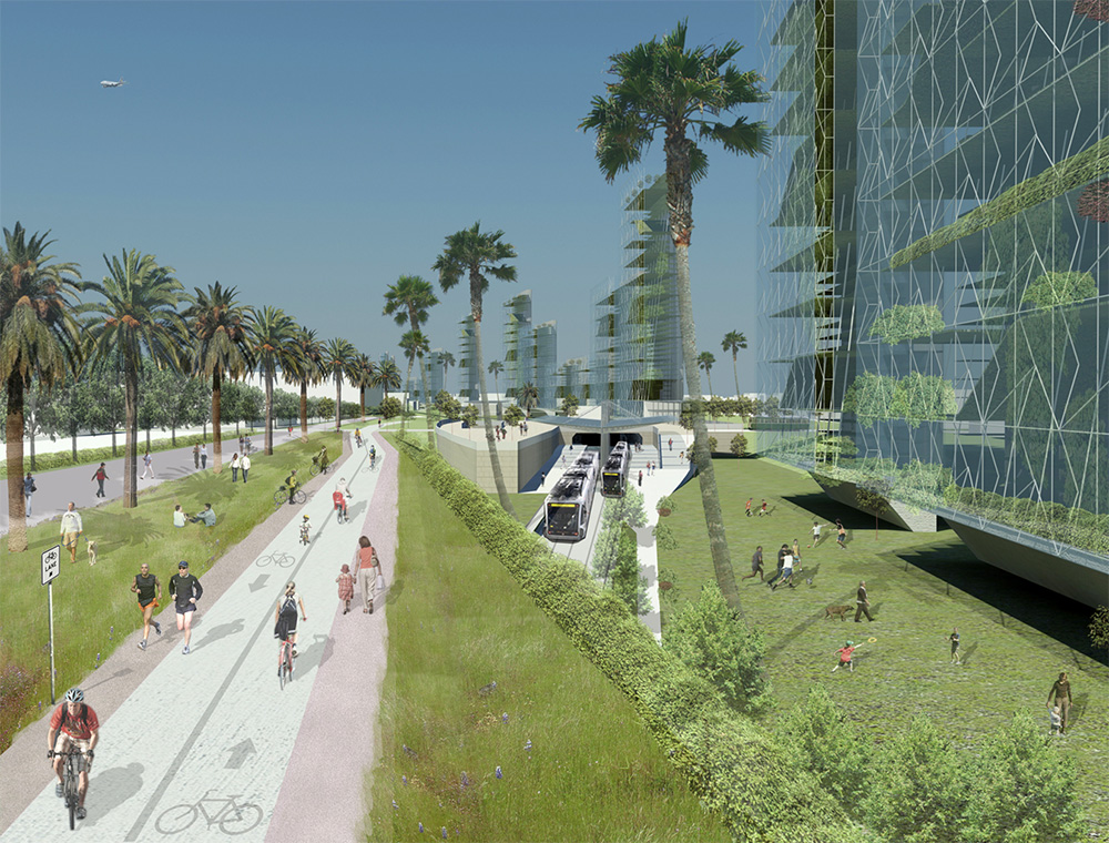
A proposed bike lane and promenade on the left, a light rail transit system below, and vertical gardens on the right
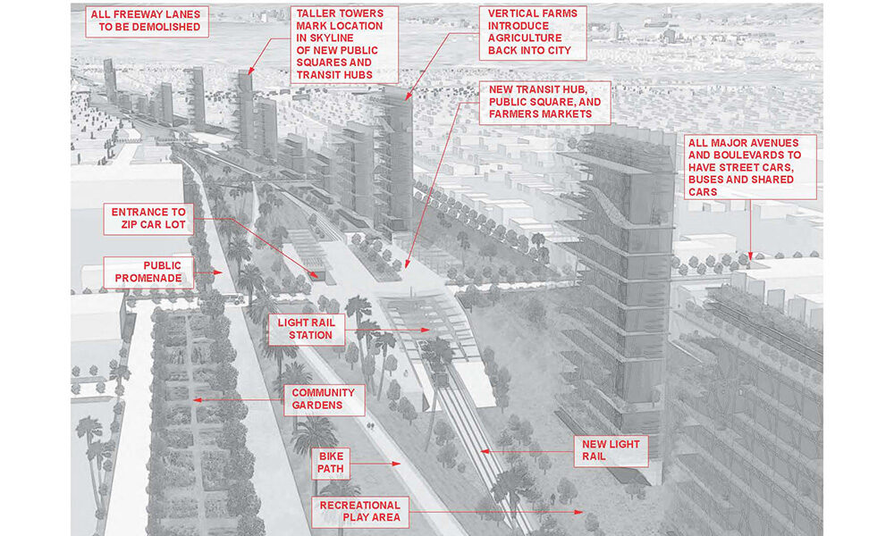
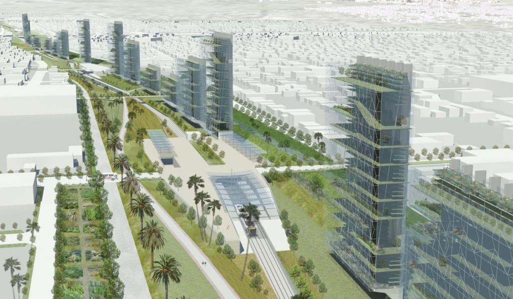
Aerial view of the proposed Greenway replacing the Santa Monica freeway
Urban connections
Virtually every resident would be within comfortable biking distance of the new greenways or existing Metro lines. This would open up access to transit and park space to millions of residents.
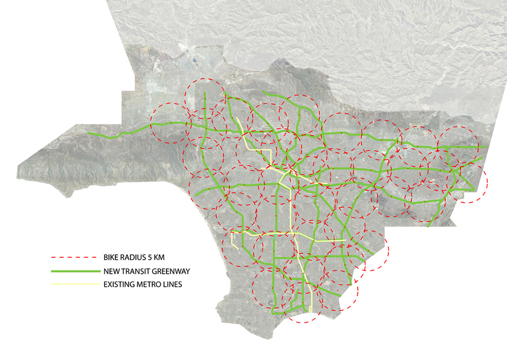
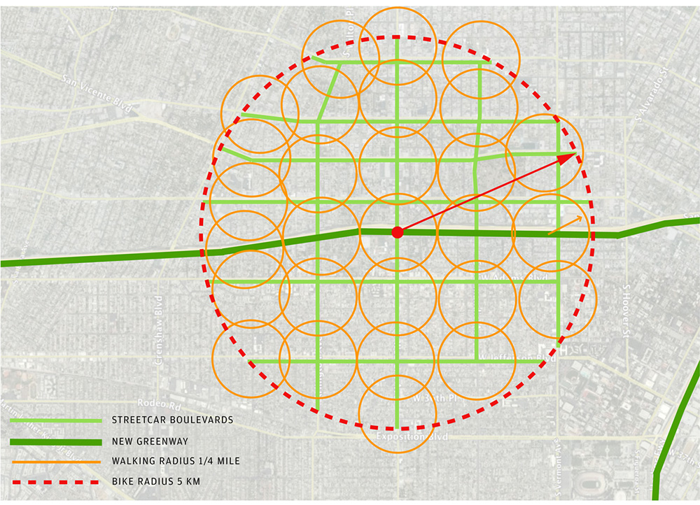
Access to the greenway system
Besides near universal bike access to the greenways, a new streetcar system on all major streets would allow residents to get to the new Greenway without a car. These streetcar systems would be accessible by walking for virtually all residents on a typical city block, as evident in this diagram.


